
Yesterday I came across this map on Twitter …
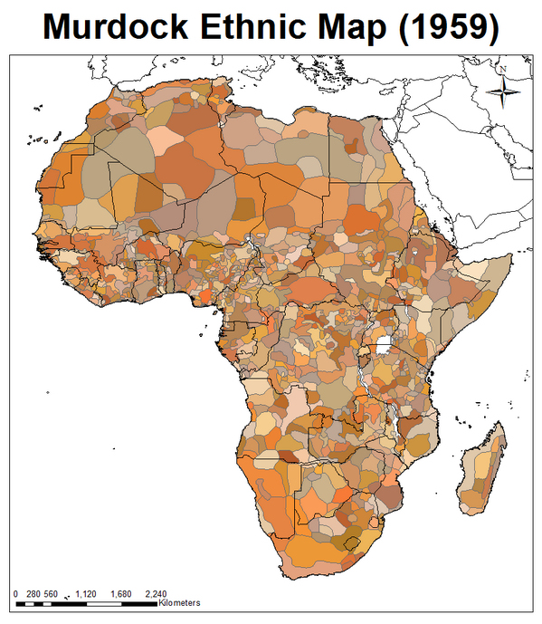
It shows Africa with its national boundaries (black lines) as they were in 1959 and (shaded) the continent’s division into ethnic/linguistic areas — ie. basically tribal areas.
Note just how many of the national boundaries are (a) straight lines and/or (b) cut straight across tribal areas. Every country contains multiple tribal/ethnic/linguistic areas.
Yet, we expect these peoples to be able to get on with each other as nations and embrace our democratic traditions. And we’re surprised when they can’t!
Is it any wonder they can’t get on, there is continual civil war and countries wanting to break themselves asunder. It is basically all the result of us, white man, drawing “arbitrary” lines on maps.